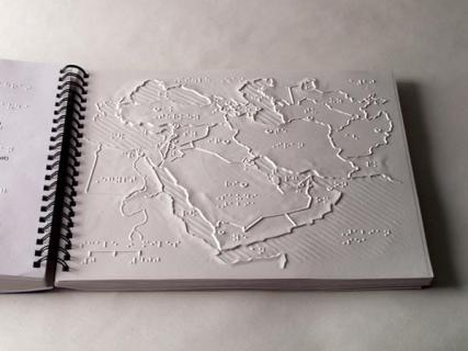
Return to Search
World Maps
American Printing House for the Blind
NA
5-06001-00
Description

These thermoformed tactile maps are a comprehensive aid to geographic instruction and orientation.

With tactile maps of all the continents, regions, and countries of the world, World Maps are reproduced from original high-quality works by The Princeton Braillists. They differ from other tactile maps in that they use clear variations in height and texture, allowing a greater amount of readable information in a given space.

Thermoformed on durable 11.5 x 11 inch vinyl, the maps include rivers, mountain ranges, bodies of water, and other physical features, and country borders and capital cities. Labeled in braille, the facing pages have key information in braille and large print.

Request This Item
You must be logged in as an in-state user to request this item.